Aloha. Nolo did not destroy Hawaiʻi statewide — and we will not pretend it did. It did create very real, localized flooding and damaging winds. If your property sits in one of those areas, the right move is not panic and not dismissal. It is to inspect carefully, document what changed, understand which storm caused it, and review your coverage before assuming there is no claim. Your property does not need to be destroyed for Hurricane Nolo to have caused a legitimate loss.
- NWS-listed gusts of 66–88 mph across the Olowalu–Ukumehame–Launiupoko corridor, West Maui
- Storm-caused outages across West Maui (Lahaina to Kapalua lost power early Sunday), plus Haʻikū and Upcountry
- Renewed flooding, runoff, mud and debris in Waiʻōhinu; Highway 11 flooding in Kaʻū
- No verified count of damaged homes or commercial buildings yet
- No insured-loss or economic-loss estimate yet
- Molokaʻi and Lānaʻi structure damage: no credible reports so far
- Sept. 25: the Insurance Commissioner added Nolo to the Lala–Lowell declaration letting insurers bring in out-of-state independent adjusters, citing the workload and the need to respond to claims timely
- Nonresident public adjusters are excluded from that declaration
- Hwy 11 closed Saturday night in Waiʻōhinu and between Nāʻālehu and Pāhala; reopened Sunday morning
- Kohala Mountain Road (Hwy 250) closed for high winds
- Olowalu brush fire (100+ acres) brought evacuation orders; no structure losses reported in the updates we reviewed
- ~12,370 Maui customers out at 7 a.m. Sunday (most in West Maui); ~10,000 West Maui customers still out at 7 p.m., restoration estimated around noon Monday
- Pukalani’s afternoon outage (~485 customers) was a precautionary Public Safety Power Shutoff, restored ~4:30 p.m. — not storm damage
- Hawaiʻi Island: 4,000+ customers out Sunday morning (Waimea to Puakō; Ocean View to Nāʻālehu)
- DOE: Nolo did not cause significant damage to its campuses; most Hawaiʻi Island and Maui schools reopen Monday
- Four Lahaina schools stay closed over power, the nearby fire and water-service reliability
At a glance
- Nolo’s center stayed well south and southwest of the main islands; it strengthened into a Category 4 after moving away. Hawaiʻi felt its outer rain bands, pressure-gradient and terrain-enhanced winds, and high surf — not its core
- Two primary geographic stories: West Maui wind (Olowalu, Ukumehame, Launiupoko, Lahaina and north) and Kaʻū flooding (Waiʻōhinu, Nāʻālehu, Pāhala, the Highway 11 corridor)
- Wind can loosen roofing, flashing and ridge caps while the roof still looks intact — and those openings leak later
- In Kaʻū, Lala and Nolo damage overlap. Two storms, two dates of loss: document what changed
- Coverage for water depends on the source and pathway — flood, wind-created opening, wind-driven rain or runoff are treated differently
- An outage or road closure does not automatically create a business claim, but some commercial policies respond — read the wording
Island by Island: What Nolo Actually Did
Nolo formed in mid-September, prompted a hurricane watch for Hawaiʻi County on September 23 and a tropical storm warning the next day, and brought its heaviest island effects Saturday and Sunday, September 26–27. Its center never came ashore. What reached the islands was rain from its northern bands, strong winds funneled and accelerated by terrain, and dangerous surf. That is why impacts were so local: a few miles made a large difference.
Maui — West Maui
- Olowalu, Ukumehame, Launiupoko: NWS-listed gusts of 88, 74 and 66 mph; NWS forecasters separately described terrain-enhanced gusts around 70 mph or greater in this corridor
- Lahaina to Kapalua: lost power early Sunday; about 10,000 West Maui customers were still out Sunday evening while crews waited for helicopter inspection of the transmission lines on the ridge above Pāpalaua Wayside Park
- Olowalu brush fire: 100+ acres, evacuation orders for Olowalu Village, firefighting complicated by the wind; no structures reported damaged in the updates we reviewed
- Haʻikū and Upcountry (Pukalani, Kula, Makawao): strong winds and smaller outages; Pukalani’s afternoon shutoff was a precautionary PSPS, not storm damage
Hawaiʻi Island — Kaʻū
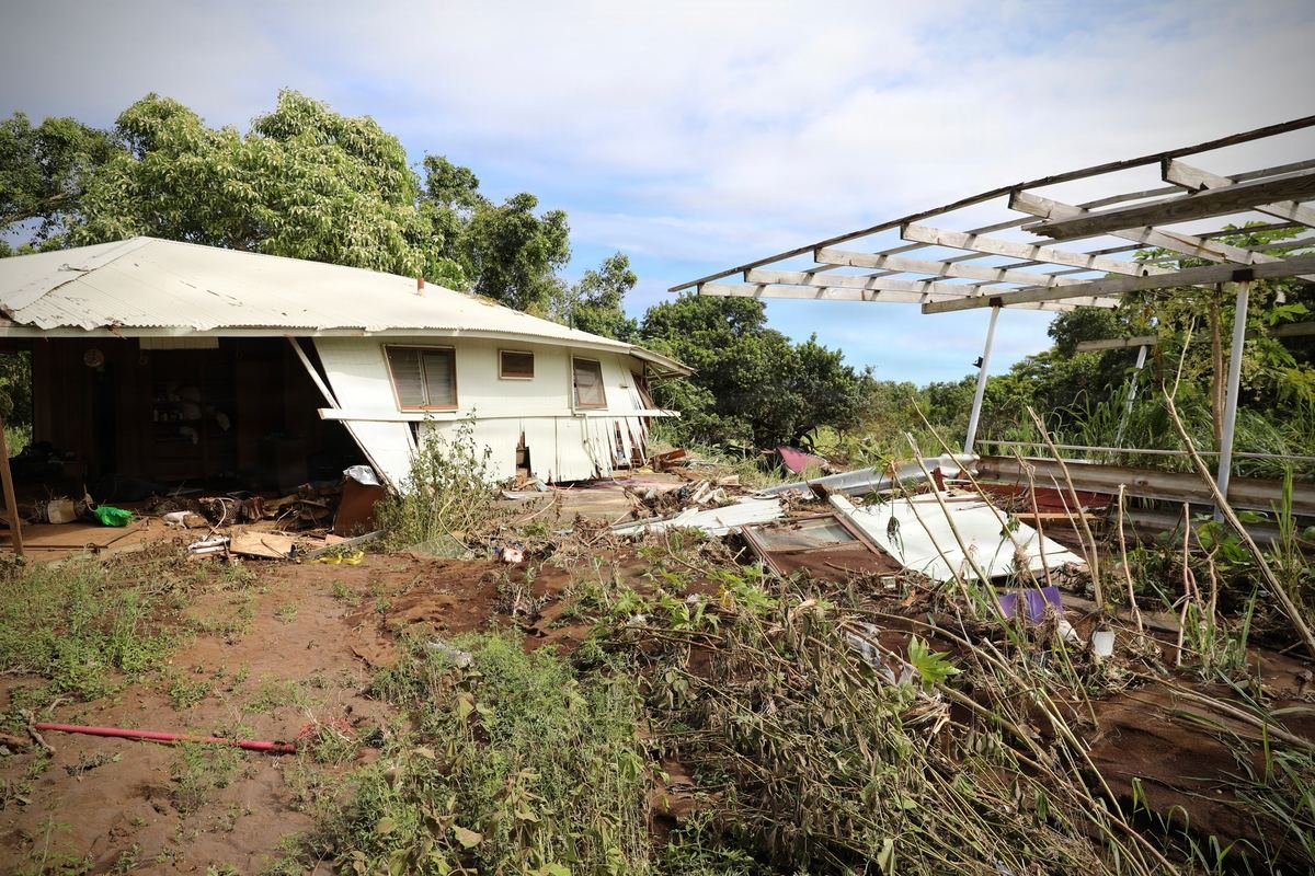
- Waiʻōhinu: water overflowed a gulch at Highway 11 Saturday evening and ran down the road into properties on both sides; mud and debris on roads, homes and buildings (Kamaʻoa Road area and Highway 11)
- Highway 11 closures: in Waiʻōhinu (Pinao Street to Kaʻalualu Road) and between Nāʻālehu and Pāhala, with flooding reported around Kaʻalaiki Road, Honuʻapo and Kawā; the highway reopened Sunday morning
- Residents were asked to limit water use on the Waiʻōhinu–Nāʻālehu system; shelters opened, including in Ocean View
- Much of the heavier devastation in these communities dates from Hurricane Lala in August — Nolo brought renewed flooding to properties still recovering
Hawaiʻi Island — Kohala & North
- NWS-listed gusts of 60–69 mph at several Hawaiʻi Island stations, including Kohala Mountain Road and Kohala Ranch
- Kohala Mountain Road (Highway 250) was closed for high winds; 4,000+ island customers lost power Sunday morning, from Waimea, Honokaʻa and Kawaihae to Puakō
Oʻahu, Molokaʻi, Lānaʻi & Kauaʻi
- Oʻahu: ridge-top gusts of 80 mph at Waimano and 74 mph in the Oʻahu Forest refuge (elevated, exposed sites); brief outages largely restored Sunday morning. No known concentration of structure damage
- Molokaʻi & Lānaʻi: under high wind warnings; no credible reports so far of concentrated building damage
- Kauaʻi: strong surf and wind, but Nolo effects look limited next to the ongoing Hurricane Lowell recovery. New damage would be a separate occurrence from Lowell
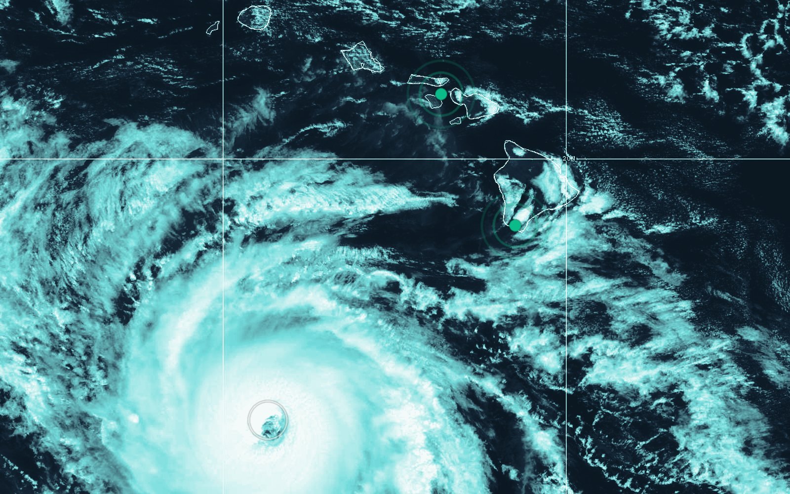
- 1West Maui
- 2Kaʻū
- 3Nolo’s eye
West Maui: Why Wind Damage Here Can Be So Local
When strong flow crosses the West Maui Mountains, it can accelerate down slopes and through gulches — so the wind at one home can be very different from a home a few miles away. That is what makes the Olowalu–Ukumehame–Launiupoko corridor stand out: several independent stations along it listed gusts from the mid-60s to 88 mph within a few hours on Saturday night.
Nolo Wind Reports — West Maui
Point observations from the National Weather Service Honolulu “Highest Wind Reports” statement (6:03 a.m. HST, Sept. 27). NWS notes these come from a variety of sources with varying equipment and exposure, and not all are considered official. Actual wind at any individual property varies with terrain, elevation, exposure and location.
These are gusts at specific stations, not a wind speed every property experienced. They are strong evidence that parts of West Maui saw potentially damaging winds — which is exactly why exposed owners should look closely rather than assume “nothing happened.” Nolo’s later 145 mph sustained winds happened far out at sea and do not describe conditions on any island.
Your Roof Can Be Damaged Even If It Still Looks Intact
Wind damage does not require a roof to blow off. Uplift can break the seal on asphalt shingles, crease tabs, pop fasteners, shift or crack tile, unseat ridge and hip pieces, flex metal panels and loosen the flashing around vents, skylights and solar mounts. Everything can still be there — and still be compromised. Often the first sign is a ceiling stain after the next heavy rain, weeks later, when the connection to the storm is harder to prove.
Storm Damage Isn’t Always Visible From the Street
- 1Roof coveringLifted, creased or missing shingles; cracked or shifted tile; loose metal panels and fasteners
- 2Ridge & hip capsCaps unseat first in uplift; the line can look straight from the street
- 3Flashing & penetrationsVents, pipe boots, skylights, wall-to-roof joints — where wind-driven rain gets in
- 4Solar / PVRacking, rails, attachments and the roof penetrations under them
- 5AtticWet decking, damp or matted insulation, staining on the underside of the roof
- 6CeilingsNew stains, bubbling paint or sagging drywall — often days after the storm
- 7Windows & screensSeals, tracks, cracked glass, bent screens, water at the sill
- 8Doors & garage doorRacked or bowed doors, damaged tracks, water under thresholds
- 9Siding & claddingLoose or cracked boards and panels, gaps that let water behind the wall
- 10Soffit & fasciaPulled or missing soffit, loose fascia, gutters and downspouts pulled away
- 11Lanai, railings & fencesAwnings, railings, gates, fencing, carports and sheds
- 12Trees & limbsStrikes on roofs and lines; fallen limbs hiding damage underneath
- 13Foundation & gradeErosion, scour, undermined slabs or posts, mud lines, retaining walls
- 14Water entryWhere water came in — through the roof, a wall, a door, or across the ground — decides the coverage question
Inspect from the ground, from inside, and from the attic hatch if it is safe. Do not climb onto a roof after a windstorm — use a qualified inspector or drone documentation.
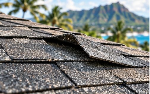

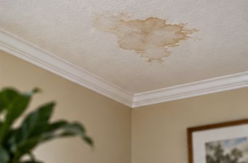
Inside, look for wind-driven rain: attic moisture, damp insulation, ceiling staining, wet walls, electrical issues, and leaks that show up later. Outside, walk every side of the building. Photograph what you see before anything is repaired.
A roof that looks fine from the street is not the same as a roof that came through the storm undamaged.
Was It Lala Damage, Nolo Damage — or Both?
This may be the most important question on this page for Kaʻū — and for anyone whose property was already hurt by Lala in August or Lowell earlier this month. Each storm is a separate event with its own date of loss. A single property might have:
Original damage
Repaired, partly repaired, documented but unrepaired, or never discovered.
Repairs, estimates, a claim in progress
Invoices, adjuster reports, contractor estimates, and photos that show the condition just before Nolo.
New damage — or old damage made worse
New wind damage, a new water entry path, fresh mud and debris, or a weakened component that finally failed.
Cause + date + mechanism + policy + prior condition + repairs
That is what we investigate, so each occurrence is presented accurately and nothing is double-counted or left out.
Keep these records together:
- Pre-Lala photos, if you have them
- Post-Lala photos and video
- Prior adjuster reports and insurance estimates
- Contractor estimates and invoices
- Repair receipts and proof of completed repairs
- Inspection and mitigation records
- Any photos from just before Nolo
- Photos and video right after Nolo
Flood vs. Wind-Driven Water: Where the Water Came From Matters
Water damage is where storm claims are most often won or lost. We will not tell you “water damage is covered” or “flood isn’t covered” — both are too simple. Coverage depends heavily on the source and pathway of the water and the exact policies and endorsements in force.
Surface flooding
Water accumulating and flowing across normally dry land and into the building. Often addressed by separate flood coverage (NFIP or private flood), depending on the policy and circumstances.
Key question: did water rise and flow in from outside?Wind damage, then rain
Wind damages a roof or opening and rain enters through it. Treatment depends on the policy language and the hurricane or wind coverage that applies.
Key question: is there a wind-created opening?Wind-driven rain, no obvious opening
Rain forced through window seals, walls or vents without visible structural damage. Coverage varies significantly from policy to policy.
Key question: what does your form say about rain without an opening?Drainage & runoff
Water moving off slopes, gulches or roads onto the property, or backing up through drains. Requires investigating how water entered and which coverage and exclusions apply.
Key question: runoff, flood, or drain backup?Many Hawaiʻi owners carry more than one policy — a homeowners or property policy, a separate hurricane policy, NFIP or private flood, or a commercial property policy. All of them may need review. A single loss can involve more than one cause.
What to Do Before Repairs or Cleanup
Document first when it is safely possible. Mitigate promptly when it is necessary. Never delay emergency protection of your property just to take pictures — policies generally expect you to prevent further damage.
- Photograph every affected area
- Take wide, medium and close-up photos of each
- Walk the property on video
- Photograph every exterior side of the building
- Document water lines and mud lines
- Photograph mud and debris before removal
- Document damaged contents individually where practical
- Write down when you discovered each item
- Keep every emergency repair invoice
- Keep every mitigation (dry-out) invoice
- Keep damaged components when reasonably possible
- Photograph temporary repairs (tarps, boards)
- Prevent additional damage where it is safe to
- Keep your Lala and Lowell claim records
- Do not climb onto a damaged or wet roof
Our First 72 Hours guide walks through this step by step, and our “It’s Just a Few Shingles” guide shows why minor-looking damage deserves a closer look.
Homeowners & Condo Owners: Coverages Worth Checking
Every claim depends on the actual policy language and the facts. Depending on your forms, these parts of a residential policy may be worth reviewing after Nolo:
Property
- Dwelling
- Other structures (fences, sheds, carports, detached garages)
- Personal property / contents
- Debris removal
- Reasonable emergency repairs
- Ordinance or law (code upgrades)
Other policies & provisions
- Additional living expense, if the home is unlivable
- Separate hurricane policy and its deductible trigger
- NFIP or private flood insurance
- Condo master policy vs. your HO-6
- Endorsements (e.g., drain or sewer backup)
Hurricane and named-storm deductibles depend on trigger language in your policy. Our Hawaiʻi hurricane deductible guide explains how to read yours.
Business & Commercial Property Owners
For businesses, Nolo’s effects may reach beyond the building — the West Maui outage, the Olowalu evacuation, Honoapiʻilani Highway disruptions and the Highway 11 closures in Kaʻū all interrupted normal operations.
Direct property
- Building, roof, glazing and exterior
- Signage and exterior fixtures
- Business personal property and inventory
- Tenant improvements and betterments
- Refrigeration, electrical and mechanical equipment
- Records
Income & operations provisions to review
- Business income
- Extra expense
- Civil authority
- Ingress / egress
- Utility service interruption
- Spoilage
- Dependent property
A power outage or road closure alone does not establish coverage. These provisions typically depend on the covered cause of loss, physical-damage requirements, distance limits, waiting periods, time limits, exclusions and endorsements. Keep closure notices, outage records, sales records and receipts — then have the wording reviewed.
Should I File a Claim?
We do not encourage filing indiscriminately. Here is the honest decision path:
The Current Claims Environment
On September 25, 2026, Hawaiʻi Insurance Commissioner Scott K. Saiki added Tropical Storm/Hurricane Nolo to the emergency declaration already covering Hurricanes Lala and Lowell. It temporarily lets qualifying out-of-state independent adjusters work Hawaiʻi claims for insurers, citing the amount of work from the storms and the need for insurers to timely respond to property owners’ claims. Nonresident public adjusters — the adjusters who represent policyholders — were specifically excluded. The declaration does not quantify Nolo claims; it does show the state expects a substantial combined catastrophe-claims workload. For you, that likely means inspectors who may be new to Hawaiʻi construction and pricing, working three storms at once.
How Island Claims Helps
Island Claims represents the policyholder — never the insurance company. We document the full scope of a covered loss and advocate for you throughout the claim:
- Property consultation
- Policy review
- Damage investigation
- Documentation
- Scope development
- Repair estimate
- Coverage analysis
- Claim presentation
- Carrier communication
- Supplements
- Negotiation & resolution
Not sure Nolo damaged anything
You were in a high-wind area or water got in, but you cannot tell what is wrong. We help investigate what happened before anything is repaired.
Lala or Lowell claim already open
We separate what each storm did — cause, date, mechanism and prior repairs — so each occurrence is presented accurately.
Business interrupted
Outage, evacuation or closure losses plus physical damage. We review the income, extra expense and civil authority wording against what actually happened.
Free Official Help
Hurricane Nolo Questions
Not Sure Whether Nolo Damaged Your Property?
You don’t need a missing roof or a flooded first floor to justify a closer look. If your property experienced Nolo’s high winds, water intrusion, flooding or other storm effects, Island Claims can help investigate what happened, document the damage and review how your insurance may apply. Your review is Complimentary. No upfront cost, ever.
Request a Nolo Property & Claim Review